
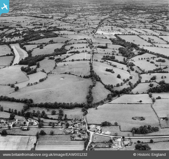
EAW001232 ENGLAND (1946). Ryknild Street (Roman Road), Swanshill Wood and the surrounding countryside, Weatheroak Hill, 1946
© Copyright OpenStreetMap contributors and licensed by the OpenStreetMap Foundation. 2025. Cartography is licensed as CC BY-SA.
Nearby Images (4)
EAW001232
, Swanshill Wood and the surrounding countryside, Weatheroak Hill, 1946")
EAW001233
, Swan's Hill and the surrounding countryside, Weatheroak Hill, 1946")
EAW001231
, Swanshill Wood and the surrounding countryside, Weatheroak Hill, 1946")
EAW001230
, Swanshill Wood and the surrounding countryside, Weatheroak Hill, 1946")
Details
| Title | [EAW001232] Ryknild Street (Roman Road), Swanshill Wood and the surrounding countryside, Weatheroak Hill, 1946 |
| Reference | EAW001232 |
| Date | 24-June-1946 |
| Link | |
| Place name | WEATHEROAK HILL |
| Parish | ALVECHURCH |
| District | |
| Country | ENGLAND |
| Easting / Northing | 405539, 274526 |
| Longitude / Latitude | -1.918638719896, 52.368372467586 |
| National Grid Reference | SP055745 |
Pins

totoro |
Thursday 28th of November 2013 09:36:20 PM | |
|
totoro |
Thursday 28th of November 2013 09:35:19 PM | |
|
totoro |
Thursday 28th of November 2013 09:34:14 PM | |
|
totoro |
Thursday 28th of November 2013 09:32:56 PM | |
|
totoro |
Thursday 28th of November 2013 09:32:14 PM | |
|
totoro |
Thursday 28th of November 2013 09:31:26 PM | |
|
totoro |
Thursday 28th of November 2013 09:30:41 PM | |
|
totoro |
Thursday 28th of November 2013 09:29:52 PM | |
|
totoro |
Thursday 28th of November 2013 09:29:11 PM | |
|
totoro |
Thursday 28th of November 2013 09:28:26 PM | |
|
totoro |
Thursday 28th of November 2013 09:27:50 PM | |
|
totoro |
Thursday 28th of November 2013 09:27:13 PM | |
|
totoro |
Thursday 28th of November 2013 09:26:28 PM | |
|
totoro |
Thursday 28th of November 2013 09:25:35 PM | |
|
totoro |
Thursday 28th of November 2013 09:25:09 PM | |
|
totoro |
Thursday 28th of November 2013 09:21:07 PM |