
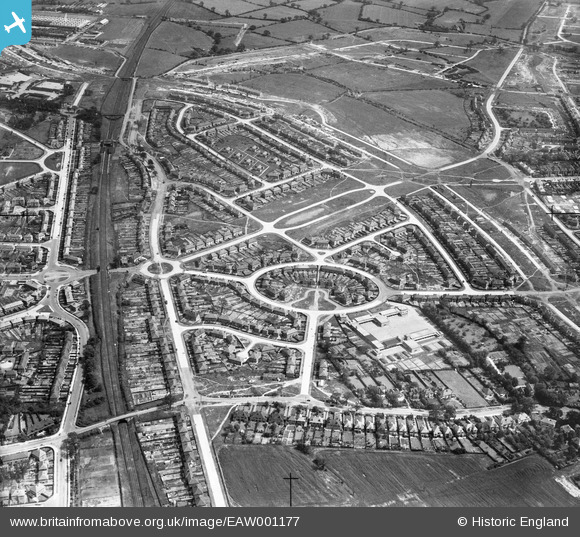
EAW001177 ENGLAND (1946). Housing estate centred upon Whittington Oval, Lea Hall, 1946
© Copyright OpenStreetMap contributors and licensed by the OpenStreetMap Foundation. 2026. Cartography is licensed as CC BY-SA.
Nearby Images (4)
EAW001177

EAW001176

EAW001172

EAW001171

Details
| Title | [EAW001177] Housing estate centred upon Whittington Oval, Lea Hall, 1946 |
| Reference | EAW001177 |
| Date | 21-June-1946 |
| Link | |
| Place name | LEA HALL |
| Parish | |
| District | |
| Country | ENGLAND |
| Easting / Northing | 414160, 286911 |
| Longitude / Latitude | -1.7914824640982, 52.479571413417 |
| National Grid Reference | SP142869 |
Pins

GenealogyGal |
Tuesday 21st of March 2023 04:08:01 PM | |
|
RussH |
Thursday 16th of September 2021 04:50:33 PM | |
|
RussH |
Thursday 16th of September 2021 04:49:00 PM | |
|
devonjim |
Saturday 1st of April 2017 01:54:56 PM | |
|
John W |
Sunday 17th of July 2016 08:22:31 PM | |
|
Lin |
Saturday 28th of May 2016 05:09:29 PM | |
|
Lin |
Saturday 28th of May 2016 05:07:12 PM | |
|
Lin |
Saturday 28th of May 2016 04:58:58 PM |