
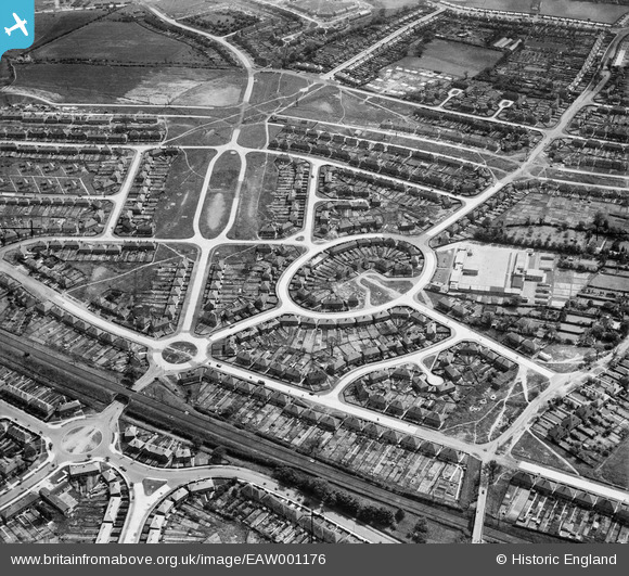
EAW001176 ENGLAND (1946). Housing estate centred upon Whittington Oval, Lea Hall, 1946
© Copyright OpenStreetMap contributors and licensed by the OpenStreetMap Foundation. 2026. Cartography is licensed as CC BY-SA.
Nearby Images (4)
EAW001176

EAW001177

EAW001172

EAW001171

Details
| Title | [EAW001176] Housing estate centred upon Whittington Oval, Lea Hall, 1946 |
| Reference | EAW001176 |
| Date | 21-June-1946 |
| Link | |
| Place name | LEA HALL |
| Parish | |
| District | |
| Country | ENGLAND |
| Easting / Northing | 414117, 286930 |
| Longitude / Latitude | -1.792114864436, 52.479743355699 |
| National Grid Reference | SP141869 |
Pins
Be the first to add a comment to this image!