
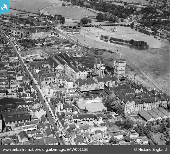
EAW001159 ENGLAND (1946). The Old Brewery (Bass) and the High Street, Burton upon Trent, 1946
© Copyright OpenStreetMap contributors and licensed by the OpenStreetMap Foundation. 2026. Cartography is licensed as CC BY-SA.
Nearby Images (12)
EAW001159
 and the High Street, Burton upon Trent, 1946")
EAW001160
 and the High Street, Burton upon Trent, 1946")
EPW005828

EPW020889

EAW001665

EAW001660

EAW001662

EAW001663

EAW051835

EAW001664

EAW001661

EPW005820

Details
| Title | [EAW001159] The Old Brewery (Bass) and the High Street, Burton upon Trent, 1946 |
| Reference | EAW001159 |
| Date | 20-June-1946 |
| Link | |
| Place name | BURTON UPON TRENT |
| Parish | BURTON |
| District | |
| Country | ENGLAND |
| Easting / Northing | 425199, 322953 |
| Longitude / Latitude | -1.6261746845667, 52.803211462693 |
| National Grid Reference | SK252230 |
Pins

Sparky |
Sunday 24th of September 2017 01:06:00 PM | |
|
Sparky |
Friday 28th of July 2017 05:06:51 PM | |
|
Sparky |
Friday 28th of July 2017 05:06:50 PM | |
|
Sparky |
Friday 28th of July 2017 05:05:15 PM | |
|
Sparky |
Friday 28th of July 2017 05:05:13 PM | |
|
Sparky |
Friday 28th of July 2017 05:04:42 PM | |
|
Sparky |
Friday 28th of July 2017 05:02:51 PM | |

Billy Turner |
Thursday 11th of February 2016 12:41:48 PM | |

John |
Saturday 28th of September 2013 10:14:22 PM |
