
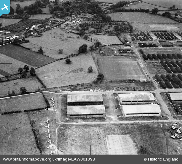
EAW001098 ENGLAND (1946). RAF Hereford (Credenhill), Credenhill, 1946
© Copyright OpenStreetMap contributors and licensed by the OpenStreetMap Foundation. 2026. Cartography is licensed as CC BY-SA.
Nearby Images (4)
EAW001098
, Credenhill, 1946")
EAW001097
, Credenhill, 1946")
EAW001101
, Credenhill, 1946")
EAW001104
, Credenhill, 1946")
Details
| Title | [EAW001098] RAF Hereford (Credenhill), Credenhill, 1946 |
| Reference | EAW001098 |
| Date | 16-June-1946 |
| Link | |
| Place name | CREDENHILL |
| Parish | CREDENHILL |
| District | |
| Country | ENGLAND |
| Easting / Northing | 345164, 243044 |
| Longitude / Latitude | -2.8003273241707, 52.082616652117 |
| National Grid Reference | SO452430 |
Pins

White Cloud |
Sunday 12th of September 2021 12:45:10 PM | |

Sparky |
Friday 28th of July 2017 09:23:51 AM | |
|
Al |
Monday 6th of January 2014 05:35:05 PM | |
|
pd brambles |
Sunday 1st of December 2013 08:56:25 PM | |
|
pd brambles |
Sunday 1st of December 2013 08:52:56 PM |
User Comment Contributions

RAF Hereford (Credenhill), Credenhill, 1946 |
Hollybush |
Saturday 24th of August 2013 11:11:31 AM |