
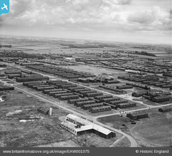
EAW001075 ENGLAND (1946). RAF Weeton, Weeton Camp, from the north-west, 1946
© Copyright OpenStreetMap contributors and licensed by the OpenStreetMap Foundation. 2026. Cartography is licensed as CC BY-SA.
Nearby Images (3)
EAW001075

EAW001074

EAW001077

Details
| Title | [EAW001075] RAF Weeton, Weeton Camp, from the north-west, 1946 |
| Reference | EAW001075 |
| Date | 3-June-1946 |
| Link | |
| Place name | WEETON CAMP |
| Parish | WEETON-WITH-PREESE |
| District | |
| Country | ENGLAND |
| Easting / Northing | 338291, 436482 |
| Longitude / Latitude | -2.9374903878663, 53.820733532746 |
| National Grid Reference | SD383365 |
Pins
Be the first to add a comment to this image!