
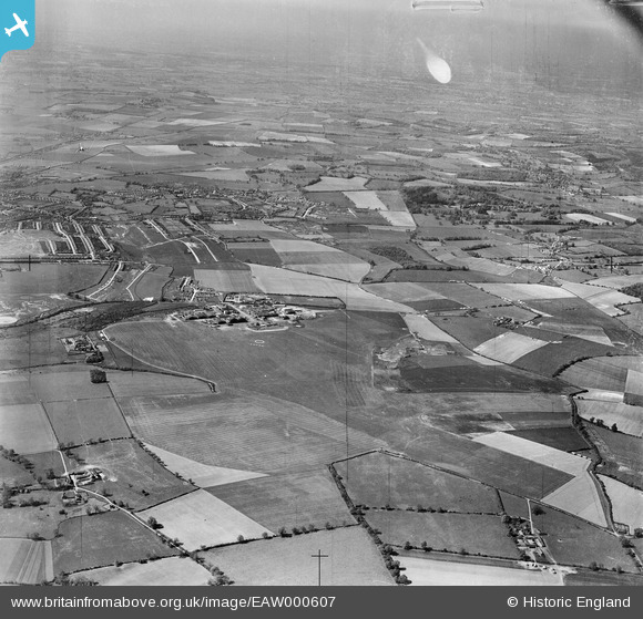
EAW000607 ENGLAND (1946). Luton Airport and the surrounding area, Luton, from the south-east, 1946. This image has been produced from a damaged negative.
© Copyright OpenStreetMap contributors and licensed by the OpenStreetMap Foundation. 2026. Cartography is licensed as CC BY-SA.
Nearby Images (2)
EAW000607

EAW000462

Details
| Title | [EAW000607] Luton Airport and the surrounding area, Luton, from the south-east, 1946. This image has been produced from a damaged negative. |
| Reference | EAW000607 |
| Date | 10-May-1946 |
| Link | |
| Place name | LUTON |
| Parish | |
| District | |
| Country | ENGLAND |
| Easting / Northing | 512358, 220841 |
| Longitude / Latitude | -0.36769001635246, 51.874366736107 |
| National Grid Reference | TL124208 |
Pins

pat |
Sunday 16th of April 2023 09:34:41 AM |