
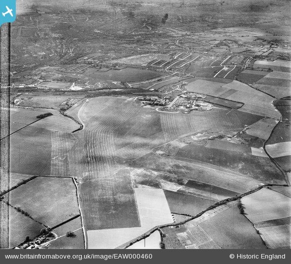
EAW000460 ENGLAND (1946). Luton Airport and environs, Luton, from the south-east, 1946
© Copyright OpenStreetMap contributors and licensed by the OpenStreetMap Foundation. 2026. Cartography is licensed as CC BY-SA.
Nearby Images (3)
EAW000460

EAW000461

EAW000462

Details
| Title | [EAW000460] Luton Airport and environs, Luton, from the south-east, 1946 |
| Reference | EAW000460 |
| Date | 3-May-1946 |
| Link | |
| Place name | LUTON |
| Parish | |
| District | |
| Country | ENGLAND |
| Easting / Northing | 512672, 221033 |
| Longitude / Latitude | -0.36306762774707, 51.876029124493 |
| National Grid Reference | TL127210 |
Pins

SteveLV |
Friday 15th of November 2013 11:36:12 AM | |
|
SteveLV |
Friday 15th of November 2013 11:34:41 AM | |
|
SteveLV |
Friday 15th of November 2013 11:33:04 AM |