
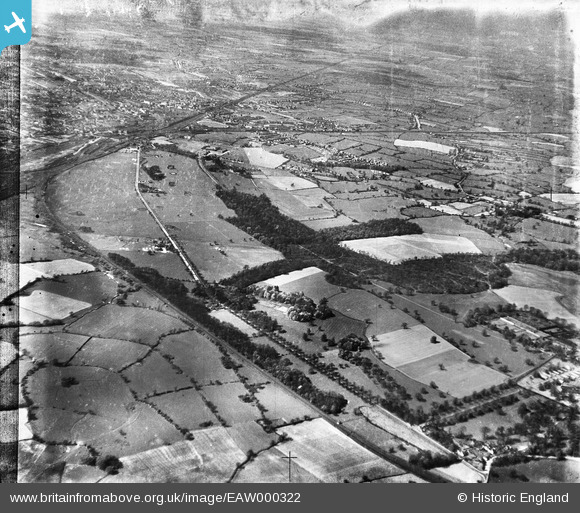
EAW000322 ENGLAND (1946). Crewe Park looking towards the town, Crewe, from the south-east, 1946
© Copyright OpenStreetMap contributors and licensed by the OpenStreetMap Foundation. 2026. Cartography is licensed as CC BY-SA.
Nearby Images (2)
EAW000322

 0°
0m
0°
0m
EAW000331
 245°
167m
245°
167m
Details
| Title | [EAW000322] Crewe Park looking towards the town, Crewe, from the south-east, 1946 |
| Reference | EAW000322 |
| Date | 19-April-1946 |
| Link | |
| Place name | CREWE GREEN |
| Parish | CREWE GREEN |
| District | |
| Country | ENGLAND |
| Easting / Northing | 372582, 353851 |
| Longitude / Latitude | -2.4093565492826, 53.080878623695 |
| National Grid Reference | SJ726539 |
Pins
 Line to Chester Line to Chester |

John W |
Monday 1st of August 2016 05:13:52 PM |
| Line north to Preston and Scotland |
John W |
Monday 1st of August 2016 05:13:16 PM |
| Line to Sandbach, Manchester etc. |
John W |
Monday 1st of August 2016 05:11:35 PM |
| Line to London |
John W |
Monday 1st of August 2016 05:10:40 PM |
| Line to Stoke |
John W |
Monday 1st of August 2016 05:10:02 PM |
| Crewe station |
John W |
Monday 1st of August 2016 05:09:05 PM |
| "Manchester Bridge" - where Earle St becomes Hungerford Rd |
SteveB |
Friday 23rd of August 2013 05:53:23 PM |
| current Crewe Green roundabout |
SteveB |
Friday 23rd of August 2013 05:52:01 PM |
| Sydney Bridge |
SteveB |
Friday 23rd of August 2013 05:50:47 PM |
| current Rookery Wood roundabout |
SteveB |
Friday 23rd of August 2013 05:48:52 PM |
| military huts in front of Crewe Hall (which is just out of picture) |
SteveB |
Friday 23rd of August 2013 05:48:06 PM |
| current drive to Crewe Hall |
SteveB |
Friday 23rd of August 2013 05:47:26 PM |