
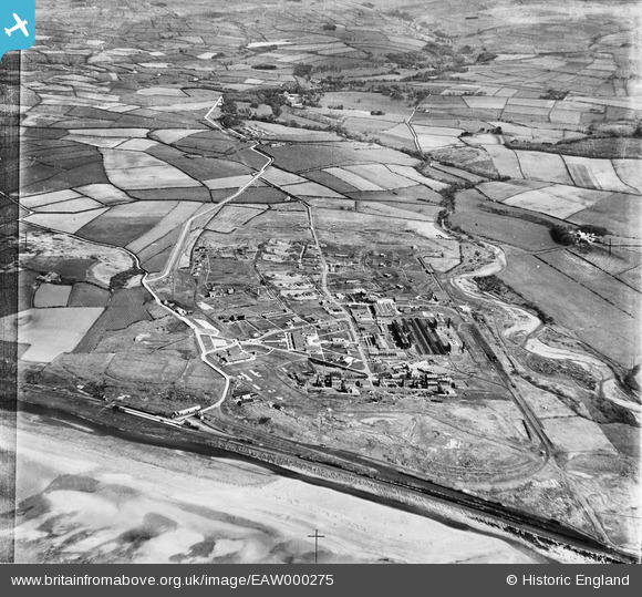
EAW000275 ENGLAND (1946). Royal Ordnance Factory at Sellafield, High Sellafield, 1946
© Copyright OpenStreetMap contributors and licensed by the OpenStreetMap Foundation. 2026. Cartography is licensed as CC BY-SA.
Nearby Images (5)
EAW000275

EAW000272

EAW000274

EAW000276

EAW000273

Details
| Title | [EAW000275] Royal Ordnance Factory at Sellafield, High Sellafield, 1946 |
| Reference | EAW000275 |
| Date | 24-April-1946 |
| Link | |
| Place name | HIGH SELLAFIELD |
| Parish | ST. BRIDGET BECKERMET |
| District | |
| Country | ENGLAND |
| Easting / Northing | 302669, 503839 |
| Longitude / Latitude | -3.5002048997628, 54.420520761993 |
| National Grid Reference | NY027038 |
Pins

Matt Aldred edob.mattaldred.com |
Friday 26th of February 2021 04:43:10 PM | |
|
Matt Aldred edob.mattaldred.com |
Friday 26th of February 2021 04:40:32 PM | |
|
Matt Aldred edob.mattaldred.com |
Friday 26th of February 2021 04:40:17 PM | |
|
Matt Aldred edob.mattaldred.com |
Friday 26th of February 2021 04:39:58 PM | |
|
Matt Aldred edob.mattaldred.com |
Friday 26th of February 2021 04:39:43 PM | |

redmist |
Sunday 7th of February 2021 10:20:13 PM | |
|
redmist |
Sunday 7th of February 2021 10:19:56 PM | |
|
redmist |
Sunday 7th of February 2021 10:19:17 PM |