
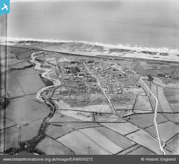
EAW000272 ENGLAND (1946). Royal Ordnance Factory at Sellafield, High Sellafield, 1946
© Copyright OpenStreetMap contributors and licensed by the OpenStreetMap Foundation. 2026. Cartography is licensed as CC BY-SA.
Nearby Images (6)
EAW000272

EAW000275

EAW000273

EAW000276

EAW000274

EAW000279

Details
| Title | [EAW000272] Royal Ordnance Factory at Sellafield, High Sellafield, 1946 |
| Reference | EAW000272 |
| Date | 24-April-1946 |
| Link | |
| Place name | HIGH SELLAFIELD |
| Parish | ST. BRIDGET BECKERMET |
| District | |
| Country | ENGLAND |
| Easting / Northing | 302712, 503761 |
| Longitude / Latitude | -3.4995167871902, 54.419828159535 |
| National Grid Reference | NY027038 |
Pins

Brian |
Sunday 4th of September 2022 09:01:33 AM | |

Matt Aldred edob.mattaldred.com |
Friday 26th of February 2021 04:46:56 PM | |
|
Matt Aldred edob.mattaldred.com |
Friday 26th of February 2021 04:46:44 PM |