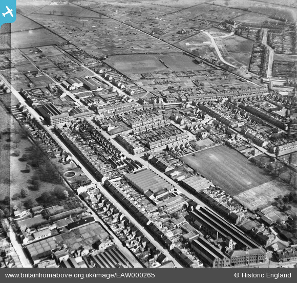
EAW000265 ENGLAND (1946). Queen Street, Portland Road and environs, Rushden, 1946
© Copyright OpenStreetMap contributors and licensed by the OpenStreetMap Foundation. 2026. Cartography is licensed as CC BY-SA.
Nearby Images (8)
Details
| Title | [EAW000265] Queen Street, Portland Road and environs, Rushden, 1946 |
| Reference | EAW000265 |
| Date | 15-April-1946 |
| Link | |
| Place name | RUSHDEN |
| Parish | RUSHDEN |
| District | |
| Country | ENGLAND |
| Easting / Northing | 496111, 266927 |
| Longitude / Latitude | -0.59064870358192, 52.291666997461 |
| National Grid Reference | SP961669 |


![[EAW000265] Queen Street, Portland Road and environs, Rushden, 1946](http://britainfromabove.org.uk/sites/all/libraries/aerofilms-images/public/100x100/EAW/000/EAW000265.jpg)
![[EAW000269] The Fred Hawkes Ltd shoe machinery works on Portland Road and surrounding streets, Rushden, 1946](http://britainfromabove.org.uk/sites/all/libraries/aerofilms-images/public/100x100/EAW/000/EAW000269.jpg)
![[EAW000266] The town, Rushden, 1946](http://britainfromabove.org.uk/sites/all/libraries/aerofilms-images/public/100x100/EAW/000/EAW000266.jpg)
![[EAW000270] The town, Rushden, 1946](http://britainfromabove.org.uk/sites/all/libraries/aerofilms-images/public/100x100/EAW/000/EAW000270.jpg)
![[EAW000264] The Fred Hawkes Ltd shoe machinery works on Portland Road, Rushden, 1946](http://britainfromabove.org.uk/sites/all/libraries/aerofilms-images/public/100x100/EAW/000/EAW000264.jpg)
![[EAW000267] The Fred Hawkes Ltd shoe machinery works on Portland Road, Rushden, 1946](http://britainfromabove.org.uk/sites/all/libraries/aerofilms-images/public/100x100/EAW/000/EAW000267.jpg)
![[EAW000268] The Fred Hawkes Ltd shoe machinery works on Portland Road, Rushden, 1946](http://britainfromabove.org.uk/sites/all/libraries/aerofilms-images/public/100x100/EAW/000/EAW000268.jpg)
![[EAW000271] The Fred Hawkes Ltd shoe machinery works on Portland Road and environs, Rushden, 1946](http://britainfromabove.org.uk/sites/all/libraries/aerofilms-images/public/100x100/EAW/000/EAW000271.jpg)
