
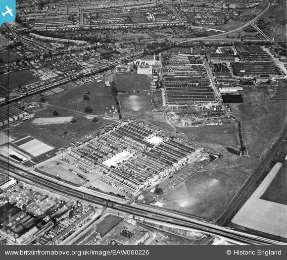
EAW000226 ENGLAND (1946). The Standard Motor Company works on Fletchampstead Highway and environs, Coventry, 1946
© Copyright OpenStreetMap contributors and licensed by the OpenStreetMap Foundation. 2026. Cartography is licensed as CC BY-SA.
Nearby Images (16)
EAW000226

EAW000228

EPW053112

EPW053123

EAW000225

EAW000231

EPW053117

EAW000229

EPW053126

EPW053120

EAW000227

EPW053118

EAW000230

EAW000144

EPW053122

EPW053121

Details
| Title | [EAW000226] The Standard Motor Company works on Fletchampstead Highway and environs, Coventry, 1946 |
| Reference | EAW000226 |
| Date | 15-April-1946 |
| Link | |
| Place name | COVENTRY |
| Parish | |
| District | |
| Country | ENGLAND |
| Easting / Northing | 430434, 278212 |
| Longitude / Latitude | -1.5526332489555, 52.400695458055 |
| National Grid Reference | SP304782 |
Pins

cabbagecaff |
Tuesday 2nd of January 2024 12:12:24 AM | |
|
cabbagecaff |
Tuesday 2nd of January 2024 12:11:51 AM | |
|
cabbagecaff |
Tuesday 2nd of January 2024 12:11:29 AM | |
|
cabbagecaff |
Tuesday 2nd of January 2024 12:11:07 AM | |
|
cabbagecaff |
Tuesday 2nd of January 2024 12:10:48 AM | |
|
redmist |
Wednesday 7th of October 2020 10:14:12 PM | |
|
redmist |
Wednesday 7th of October 2020 10:13:28 PM | |
|
redmist |
Wednesday 7th of October 2020 10:12:55 PM | |
|
redmist |
Wednesday 7th of October 2020 10:12:28 PM | |

Sparky |
Thursday 31st of August 2017 10:02:23 PM |