
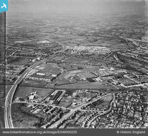
EAW000225 ENGLAND (1946). The Standard Motor Company works and environs, Coventry, from the south-east, 1946
© Copyright OpenStreetMap contributors and licensed by the OpenStreetMap Foundation. 2026. Cartography is licensed as CC BY-SA.
Nearby Images (9)
EAW000225

EPW053112

EAW000226

EAW000139

EAW000137

EPW053123

EPW053114

EAW000228

EPW053113

Details
| Title | [EAW000225] The Standard Motor Company works and environs, Coventry, from the south-east, 1946 |
| Reference | EAW000225 |
| Date | 15-April-1946 |
| Link | |
| Place name | COVENTRY |
| Parish | |
| District | |
| Country | ENGLAND |
| Easting / Northing | 430596, 278263 |
| Longitude / Latitude | -1.5502473354598, 52.401144956867 |
| National Grid Reference | SP306783 |
Pins

redmist |
Wednesday 7th of October 2020 10:10:27 PM | |
|
redmist |
Wednesday 7th of October 2020 10:09:35 PM | |
|
redmist |
Wednesday 7th of October 2020 10:08:44 PM | |
|
redmist |
Wednesday 7th of October 2020 10:08:03 PM | |
|
Josh |
Thursday 11th of April 2019 12:34:56 PM | |
|
redmist |
Tuesday 18th of December 2018 08:55:52 PM |