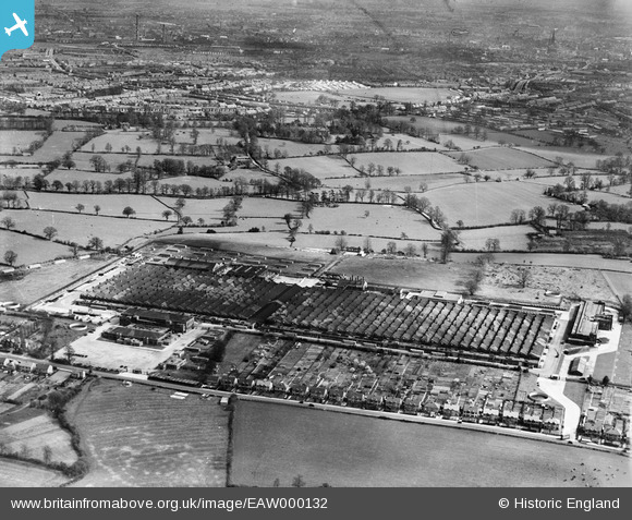
EAW000132 ENGLAND (1946). Browns Lane Motor Works and environs, Allesley, 1946
© Copyright OpenStreetMap contributors and licensed by the OpenStreetMap Foundation. 2025. Cartography is licensed as CC BY-SA.
Details
| Title | [EAW000132] Browns Lane Motor Works and environs, Allesley, 1946 |
| Reference | EAW000132 |
| Date | 9-April-1946 |
| Link | |
| Place name | ALLESLEY |
| Parish | |
| District | |
| Country | ENGLAND |
| Easting / Northing | 430239, 281546 |
| Longitude / Latitude | -1.5551980733547, 52.430681712056 |
| National Grid Reference | SP302815 |
Pins
 redmist |
Thursday 8th of October 2020 08:21:05 PM | |
 Sparky |
Wednesday 1st of November 2017 07:54:15 AM | |
 Sparky |
Wednesday 1st of November 2017 07:53:28 AM | |
 Sparky |
Wednesday 1st of November 2017 07:52:55 AM | |
 Sparky |
Tuesday 25th of July 2017 10:20:01 PM | |
 JG |
Saturday 14th of September 2013 03:05:28 PM |


![[EAW000132] Browns Lane Motor Works and environs, Allesley, 1946](http://britainfromabove.org.uk/sites/all/libraries/aerofilms-images/public/100x100/EAW/000/EAW000132.jpg)
![[EAW000033] The Daimler Motor Company Ltd shadow factory at Browns Lane, Coventry, 1946](http://britainfromabove.org.uk/sites/all/libraries/aerofilms-images/public/100x100/EAW/000/EAW000033.jpg)
![[EAW000034] The Daimler Motor Company Ltd shadow factory at Browns Lane, Coventry, 1946](http://britainfromabove.org.uk/sites/all/libraries/aerofilms-images/public/100x100/EAW/000/EAW000034.jpg)
![[EAW000030] The Daimler Motor Company Ltd shadow factory at Browns Lane, Coventry, 1946](http://britainfromabove.org.uk/sites/all/libraries/aerofilms-images/public/100x100/EAW/000/EAW000030.jpg)