
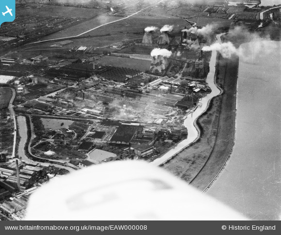
EAW000008 ENGLAND (1946). River Lea Navigation, Brimsdown Power Station and environs, Brimsdown, 1946
© Copyright OpenStreetMap contributors and licensed by the OpenStreetMap Foundation. 2026. Cartography is licensed as CC BY-SA.
Nearby Images (26)
EAW000008

EPW008046

EAW021764

EAW021773

EPW044233

EAW021772

EAW021766

EAW021765

EPW008043

EAW021774

EAW005271

EAW021761

EAW021762

EPW008045

EPW046482

EAW021763

EPW044228

EPW008044

EAW004479

EPW046484

EAW004480

EPW025596

EPW044232

EPW025595

EPW008032

EPW008036

Details
| Title | [EAW000008] River Lea Navigation, Brimsdown Power Station and environs, Brimsdown, 1946 |
| Reference | EAW000008 |
| Date | 24-January-1946 |
| Link | |
| Place name | BRIMSDOWN |
| Parish | |
| District | |
| Country | ENGLAND |
| Easting / Northing | 536912, 197001 |
| Longitude / Latitude | -0.020581338210338, 51.654636203851 |
| National Grid Reference | TQ369970 |
Pins

Sparky |
Friday 11th of August 2017 10:40:23 PM |