
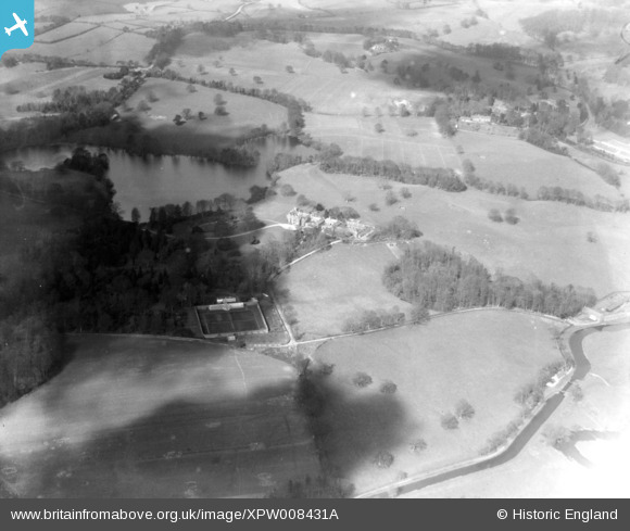
XPW008431A NORTHERN IRELAND (1923). Ballydrain House, Drumbeg, Lisburn, Northern Ireland, 1923. Oblique aerial photograph taken facing North.
© Copyright OpenStreetMap contributors and licensed by the OpenStreetMap Foundation. 2024. Cartography is licensed as CC BY-SA.
Nearby Images (2)
XPW008431A

XPW008431

Details
| Title | [XPW008431A] Ballydrain House, Drumbeg, Lisburn, Northern Ireland, 1923. Oblique aerial photograph taken facing North. |
| Reference | XPW008431A |
| Date | 1923 |
| Link | |
| Place name | DRUMBEG |
| Parish | NORTHERN IRELAND |
| District | |
| Country | NORTHERN IRELAND |
| Easting / Northing | 143158, 522753 |
| Longitude / Latitude | -5.971757, 54.534732 |
| National Grid Reference |
Pins
Be the first to add a comment to this image!