
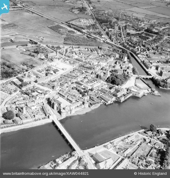
XAW044821 IRELAND (1952). General View, Limerick, Limerick, Ireland, 1952. Oblique aerial photograph taken facing South/East.
© Copyright OpenStreetMap contributors and licensed by the OpenStreetMap Foundation. 2024. Cartography is licensed as CC BY-SA.
Nearby Images (6)
XAW044821

XAW009596

XAW044818

XAW044820

XAW044822

XAW044811

Details
| Title | [XAW044821] General View, Limerick, Limerick, Ireland, 1952. Oblique aerial photograph taken facing South/East. |
| Reference | XAW044821 |
| Date | 21-July-1952 |
| Link | |
| Place name | LIMERICK |
| Parish | IRELAND |
| District | |
| Country | IRELAND |
| Easting / Northing | -47493, 328542 |
| Longitude / Latitude | -8.622678, 52.669113 |
| National Grid Reference |
Pins
 Antoinireland |
Saturday 13th of July 2024 06:30:27 PM | |
Antoinireland |
Saturday 13th of July 2024 06:28:21 PM | |
Antoinireland |
Saturday 13th of July 2024 06:22:57 PM | |
Antoinireland |
Saturday 13th of July 2024 06:22:40 PM | |
Antoinireland |
Saturday 13th of July 2024 06:22:15 PM | |
Antoinireland |
Saturday 13th of July 2024 06:21:28 PM |