
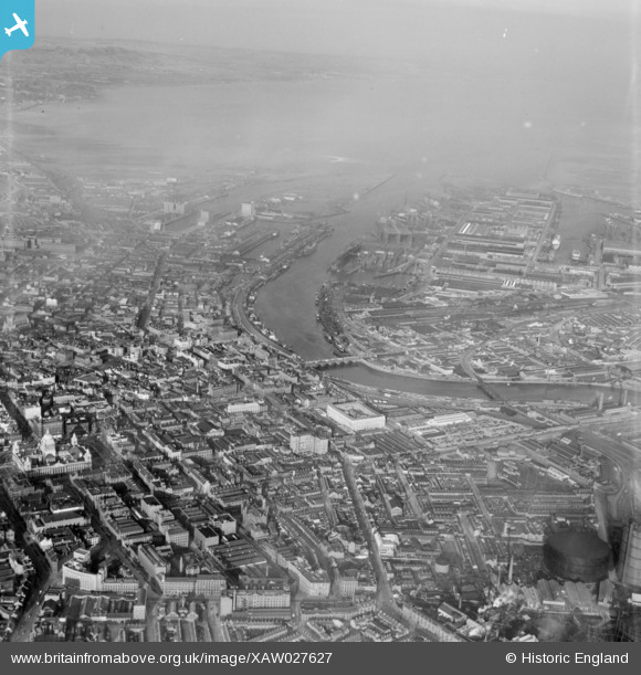
XAW027627 NORTHERN IRELAND (1949). General View, Belfast, Belfast, Northern Ireland, 1949. Oblique aerial photograph taken facing North.
© Copyright OpenStreetMap contributors and licensed by the OpenStreetMap Foundation. 2024. Cartography is licensed as CC BY-SA.
Nearby Images (2)
XAW027627

XPW042479

Details
| Title | [XAW027627] General View, Belfast, Belfast, Northern Ireland, 1949. Oblique aerial photograph taken facing North. |
| Reference | XAW027627 |
| Date | 2-November-1949 |
| Link | |
| Place name | BELFAST |
| Parish | NORTHERN IRELAND |
| District | |
| Country | NORTHERN IRELAND |
| Easting / Northing | 146625, 529630 |
| Longitude / Latitude | -5.924224, 54.598131 |
| National Grid Reference |
Pins
 SebastianG1 |
Thursday 31st of August 2023 02:24:06 PM | |
Stephen Craig |
Sunday 5th of April 2015 02:10:50 PM |


