
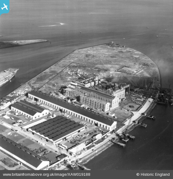
XAW019188 NORTHERN IRELAND (1948). Harbour Power Station, Belfast, Belfast, Northern Ireland, 1948. Oblique aerial photograph taken facing North.
© Copyright OpenStreetMap contributors and licensed by the OpenStreetMap Foundation. 2024. Cartography is licensed as CC BY-SA.
Nearby Images (4)
XAW019188

XAW019187

XAW019186

XPW042470

Details
| Title | [XAW019188] Harbour Power Station, Belfast, Belfast, Northern Ireland, 1948. Oblique aerial photograph taken facing North. |
| Reference | XAW019188 |
| Date | 25-September-1948 |
| Link | |
| Place name | BELFAST |
| Parish | NORTHERN IRELAND |
| District | |
| Country | NORTHERN IRELAND |
| Easting / Northing | 148731, 531920 |
| Longitude / Latitude | -5.893669, 54.619714 |
| National Grid Reference |
Pins
Be the first to add a comment to this image!


