
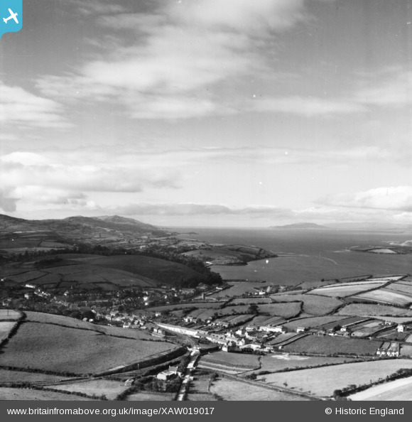
XAW019017 IRELAND (1948). Bantry Bay, Bantry, Cork, Ireland, 1948. Oblique aerial photograph taken facing West.
© Copyright OpenStreetMap contributors and licensed by the OpenStreetMap Foundation. 2024. Cartography is licensed as CC BY-SA.
Nearby Images (3)
XAW019017

XAW019018

XAW019019

Details
| Title | [XAW019017] Bantry Bay, Bantry, Cork, Ireland, 1948. Oblique aerial photograph taken facing West. |
| Reference | XAW019017 |
| Date | 23-September-1948 |
| Link | |
| Place name | BANTRY |
| Parish | IRELAND |
| District | |
| Country | IRELAND |
| Easting / Northing | -115105, 224272 |
| Longitude / Latitude | -9.456336, 51.679911 |
| National Grid Reference |
Pins
 powerpop |
Tuesday 3rd of March 2020 05:01:46 PM | |
powerpop |
Tuesday 3rd of March 2020 04:51:53 PM | |
powerpop |
Saturday 2nd of May 2015 06:08:42 PM | |
powerpop |
Saturday 2nd of May 2015 06:08:03 PM | |
powerpop |
Saturday 2nd of May 2015 06:06:48 PM |


