
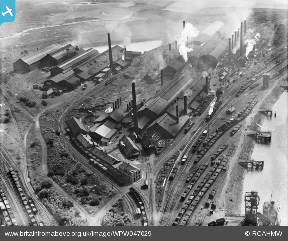
WPW047029 WALES (1935). View of Baglan Bay tinplate works, Whitford and Albion works, Briton Ferry from the north, oblique aerial view. 5"x4" black and white glass plate negative.
© Copyright OpenStreetMap contributors and licensed by the OpenStreetMap Foundation. 2024. Cartography is licensed as CC BY-SA.
Nearby Images (14)
WPW045720
, oblique aerial view. 5\"x4\" black and white glass plate negative.")
WPW045721

WPW045722

WPW045723

WPW045724

WPW047029

WPW047030

WPW047031

WPW047032

WPW047033

WPW047034

WPW047035

WPW006098

WPW006099

Details
| Title | [WPW047029] View of Baglan Bay tinplate works, Whitford and Albion works, Briton Ferry from the north, oblique aerial view. 5"x4" black and white glass plate negative. |
| Reference | WPW047029 |
| Date | 1935 |
| Link | Coflein Archive Item 6369948 |
| Place name | |
| Parish | |
| District | |
| Country | WALES |
| Easting / Northing | 273837, 193632 |
| Longitude / Latitude | -3.8228874347905, 51.626872320732 |
| National Grid Reference | SS738936 |
Pins
Be the first to add a comment to this image!