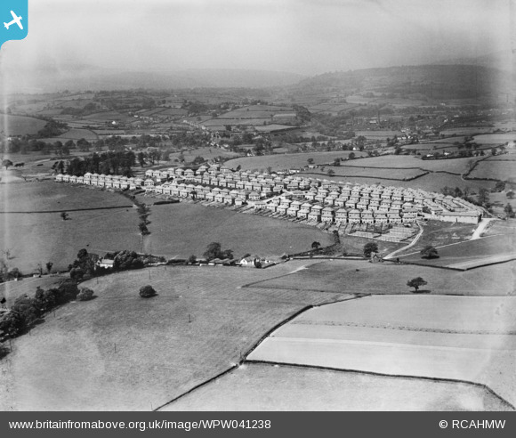
WPW041238 WALES (1933). View of Gaer housing estate, Newport, oblique aerial view. 5"x4" black and white glass plate negative.
© Copyright OpenStreetMap contributors and licensed by the OpenStreetMap Foundation. 2024. Cartography is licensed as CC BY-SA.
Details
| Title | [WPW041238] View of Gaer housing estate, Newport, oblique aerial view. 5"x4" black and white glass plate negative. |
| Reference | WPW041238 |
| Date | 1933 |
| Link | Coflein Archive Item 6369736 |
| Place name | |
| Parish | |
| District | |
| Country | WALES |
| Easting / Northing | 329240, 187060 |
| Longitude / Latitude | -3.0212521701848, 51.57748256764 |
| National Grid Reference | ST292871 |
Pins
 Class31 |
Tuesday 7th of June 2016 11:52:26 AM | |
 Class31 |
Tuesday 7th of June 2016 11:51:40 AM | |
 Class31 |
Tuesday 7th of June 2016 11:50:08 AM | |
 and1newport |
Friday 6th of July 2012 06:41:15 PM | |
 and1newport |
Friday 29th of June 2012 10:53:55 PM | |
 and1newport |
Friday 29th of June 2012 04:38:54 PM | |
 and1newport |
Friday 29th of June 2012 04:33:40 PM | |
 lenny |
Friday 29th of June 2012 12:26:14 PM | |
 lenny |
Thursday 28th of June 2012 07:48:02 PM | |
 lenny |
Thursday 28th of June 2012 07:48:02 PM | |
 Brian Wilkinson |
Wednesday 13th of June 2012 09:13:59 AM | |
The inn was formerly Gaer-fach or Little Gaer farm |
 and1newport |
Friday 29th of June 2012 10:57:03 PM |
 Brian Wilkinson |
Wednesday 13th of June 2012 09:13:20 AM | |
 Brian Wilkinson |
Friday 25th of May 2012 03:11:37 PM |
User Comment Contributions
The Gaer Hillfort, Newport, 06/10/2015 |
 Class31 |
Tuesday 7th of June 2016 11:56:12 AM |
The Gaer Hillfort, Newport, 06/10/2015 |
 Class31 |
Tuesday 7th of June 2016 11:55:09 AM |
Gaer Park Road, Newport, 06/10/2015 |
 Class31 |
Tuesday 7th of June 2016 11:53:42 AM |
Gaer Park Drive, Newport, 06/10/2015 |
 Class31 |
Tuesday 7th of June 2016 11:50:51 AM |
 owain |
Thursday 28th of June 2012 12:06:37 PM | |
 Brian Wilkinson |
Friday 22nd of June 2012 12:14:52 PM |


