
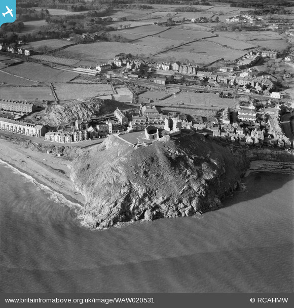
WAW020531 WALES (1948). View of Criccieth showing castle
© Copyright OpenStreetMap contributors and licensed by the OpenStreetMap Foundation. 2024. Cartography is licensed as CC BY-SA.
Nearby Images (6)
WAW020528

WAW020529

WAW020530

WAW020531

WAW020532

WAW020533

Details
| Title | [WAW020531] View of Criccieth showing castle |
| Reference | WAW020531 |
| Date | 10-November-1948 |
| Link | Coflein Archive Item 6413968 |
| Place name | |
| Parish | |
| District | |
| Country | WALES |
| Easting / Northing | 249956, 337812 |
| Longitude / Latitude | -4.2318415245559, 52.916424908637 |
| National Grid Reference | SH500378 |
Pins
 Shemeatra |
Friday 23rd of May 2014 07:45:55 PM | |
 Class31 |
Sunday 18th of May 2014 10:46:43 PM | |
Class31 |
Sunday 18th of May 2014 10:45:17 PM | |
Class31 |
Sunday 18th of May 2014 10:32:47 PM | |
Originally part of the Cambrian Railway's line to Pwllheli. Became part of the Great Western Railway in the 1923 'Grouping', thence to the BR Western Region. But in 1963 BR made significant boundary changes and this line became part of the London Midland Region of BR. |
John W |
Saturday 10th of December 2016 06:34:45 PM |


