
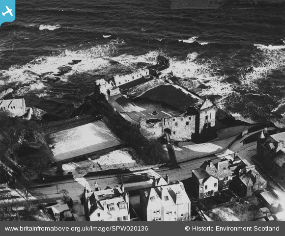
SPW020136 SCOTLAND (1927). St Andrews Castle. An oblique aerial photograph taken facing north-east. This image has been produced from a print.
© Copyright OpenStreetMap contributors and licensed by the OpenStreetMap Foundation. 2024. Cartography is licensed as CC BY-SA.
Nearby Images (9)
SPW020136

SAW016930

SAW016931

SAW024475

SAW016929

SAW016932

SPW040389

SPW040384

SPW040385

Details
| Title | [SPW020136] St Andrews Castle. An oblique aerial photograph taken facing north-east. This image has been produced from a print. |
| Reference | SPW020136 |
| Date | 1927 |
| Link | Canmore Collection item 1315395 |
| Place name | |
| Parish | ST ANDREWS AND ST LEONARDS |
| District | NORTH EAST FIFE |
| Country | SCOTLAND |
| Easting / Northing | 351260, 716930 |
| Longitude / Latitude | -2.7885621216789, 56.342302042812 |
| National Grid Reference | NO513169 |
Pins
Be the first to add a comment to this image!


