
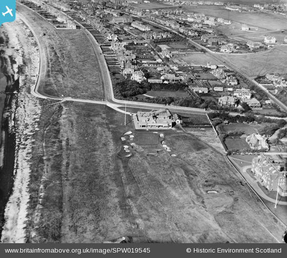
SPW019545 SCOTLAND (1927). Royal Troon Golf Course, Craigend Road, Troon, showing Club House. An oblique aerial photograph taken facing north.
© Copyright OpenStreetMap contributors and licensed by the OpenStreetMap Foundation. 2024. Cartography is licensed as CC BY-SA.
Nearby Images (2)
SPW019545

SAR016634

Details
| Title | [SPW019545] Royal Troon Golf Course, Craigend Road, Troon, showing Club House. An oblique aerial photograph taken facing north. |
| Reference | SPW019545 |
| Date | 1927 |
| Link | Canmore Collection item 1246308 |
| Place name | |
| Parish | DUNDONALD (KYLE AND CARRICK) |
| District | KYLE AND CARRICK |
| Country | SCOTLAND |
| Easting / Northing | 232800, 629745 |
| Longitude / Latitude | -4.6495936895166, 55.532731113667 |
| National Grid Reference | NS328297 |
Pins
Be the first to add a comment to this image!
User Comment Contributions
Dear Mark, Thank you for pointing out this error. I will ask my colleagues to correct the entry. Best wishes, Brian Wilkinson Britain from Above Activity Officer (Scotland) |
 Brian Wilkinson |
Tuesday 23rd of October 2012 12:32:01 PM |
This is the Old Course and Clubhouse, not the Portland Course. Mark Rowlinson 01/07/12 |
Mark Rowlinson |
Sunday 1st of July 2012 06:33:44 PM |