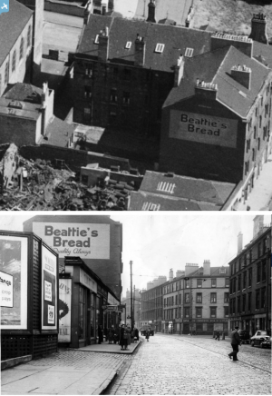
SAW046344 SCOTLAND (1952). Glasgow, general view, showing Eastern District Hospital, Duke Street and Westercraigs. An oblique aerial photograph taken facing east. This image has been produced from a crop marked negative.
© Copyright OpenStreetMap contributors and licensed by the OpenStreetMap Foundation. 2024. Cartography is licensed as CC BY-SA.
Nearby Images (10)
Details
| Title | [SAW046344] Glasgow, general view, showing Eastern District Hospital, Duke Street and Westercraigs. An oblique aerial photograph taken facing east. This image has been produced from a crop marked negative. |
| Reference | SAW046344 |
| Date | 1952 |
| Link | Canmore Collection item 1297741 |
| Place name | |
| Parish | GLASGOW (CITY OF GLASGOW) |
| District | CITY OF GLASGOW |
| Country | SCOTLAND |
| Easting / Northing | 260772, 665063 |
| Longitude / Latitude | -4.2246800822089, 55.858648447434 |
| National Grid Reference | NS608651 |
Pins
 Billy Turner |
Wednesday 5th of June 2019 05:32:32 PM | |
 smartieplum |
Tuesday 11th of August 2015 02:21:42 PM | |
 smartieplum |
Tuesday 11th of August 2015 02:20:50 PM | |
 Billy Turner |
Wednesday 10th of September 2014 11:23:10 AM | |
 Billy Turner |
Wednesday 10th of September 2014 11:19:53 AM | |
 James Aitken |
Thursday 24th of January 2013 04:43:43 PM | |
 Class31 |
Monday 19th of November 2012 09:49:15 AM | |
 Class31 |
Monday 19th of November 2012 09:48:50 AM | |
 Class31 |
Monday 19th of November 2012 09:48:28 AM | |
 smartieplum |
Thursday 16th of August 2012 09:21:50 PM |


![[SAW046337] Glasgow, general view, showing Eastern District Hospital, Duke Street and Tennant's Wellpark Brewery. An oblique aerial photograph taken facing north-west. This image has been produced from a crop marked negative.](http://britainfromabove.org.uk/sites/all/libraries/aerofilms-images/public/100x100/SAW/046/SAW046337.jpg)
![[SAW046338] Glasgow, general view, showing Eastern District Hospital, Duke Street and Westercraigs. An oblique aerial photograph taken facing east. This image has been produced from a crop marked negative.](http://britainfromabove.org.uk/sites/all/libraries/aerofilms-images/public/100x100/SAW/046/SAW046338.jpg)
![[SAW046339] Eastern District Hospital, Duke Street, Glasgow. An oblique aerial photograph taken facing north-east. This image has been produced from a crop marked negative.](http://britainfromabove.org.uk/sites/all/libraries/aerofilms-images/public/100x100/SAW/046/SAW046339.jpg)
![[SAW046340] Glasgow, general view, showing Eastern District Hospital, Duke Street and Dunchattan Street. An oblique aerial photograph taken facing north. This image has been produced from a crop marked negative.](http://britainfromabove.org.uk/sites/all/libraries/aerofilms-images/public/100x100/SAW/046/SAW046340.jpg)
![[SAW046341] Glasgow, general view, showing Eastern District Hospital, Duke Street and Westercraigs. An oblique aerial photograph taken facing north. This image has been produced from a crop marked negative.](http://britainfromabove.org.uk/sites/all/libraries/aerofilms-images/public/100x100/SAW/046/SAW046341.jpg)
![[SAW046342] Glasgow, general view, showing Eastern District Hospital, Duke Street and Cattle Market, Bellgrove Street. An oblique aerial photograph taken facing south. This image has been produced from a crop marked negative.](http://britainfromabove.org.uk/sites/all/libraries/aerofilms-images/public/100x100/SAW/046/SAW046342.jpg)
![[SAW046343] Glasgow, general view, showing Eastern District Hospital, Duke Street and Dunchattan Street. An oblique aerial photograph taken facing north. This image has been produced from a crop marked negative.](http://britainfromabove.org.uk/sites/all/libraries/aerofilms-images/public/100x100/SAW/046/SAW046343.jpg)
![[SAW046344] Glasgow, general view, showing Eastern District Hospital, Duke Street and Westercraigs. An oblique aerial photograph taken facing east. This image has been produced from a crop marked negative.](http://britainfromabove.org.uk/sites/all/libraries/aerofilms-images/public/100x100/SAW/046/SAW046344.jpg)
![[SAW046345] Glasgow, general view, showing Eastern District Hospital, Duke Street and Tennant's Wellpark Brewery. An oblique aerial photograph taken facing north-west. This image has been produced from a crop marked negative.](http://britainfromabove.org.uk/sites/all/libraries/aerofilms-images/public/100x100/SAW/046/SAW046345.jpg)
![[SPW053584] Cattle Market, Bellgrove Street and College Goods Yard, High Street, Glasgow. An oblique aerial photograph taken facing west. This image has been produced from a print.](http://britainfromabove.org.uk/sites/all/libraries/aerofilms-images/public/100x100/SPW/053/SPW053584.jpg)
