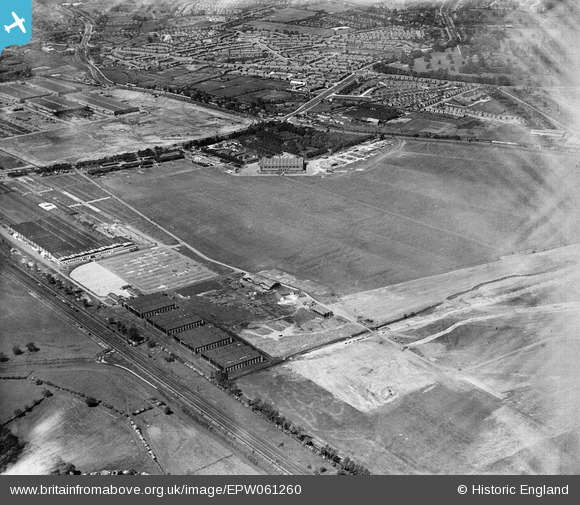
EPW061260 ENGLAND (1939). Castle Bromwich Aerodrome, Castle Vale, 1939. This image has been affected by flare.
© Copyright OpenStreetMap contributors and licensed by the OpenStreetMap Foundation. 2024. Cartography is licensed as CC BY-SA.
Details
| Title | [EPW061260] Castle Bromwich Aerodrome, Castle Vale, 1939. This image has been affected by flare. |
| Reference | EPW061260 |
| Date | 31-May-1939 |
| Link | |
| Place name | CASTLE VALE |
| Parish | |
| District | |
| Country | ENGLAND |
| Easting / Northing | 414473, 291042 |
| Longitude / Latitude | -1.7866936506237, 52.516704681649 |
| National Grid Reference | SP145910 |
Pins
 Paul Reynolds |
Monday 24th of September 2018 09:32:40 PM | |
 ken |
Wednesday 12th of August 2015 02:38:42 PM |
User Comment Contributions
The name "Castle Vale" is the modern name ;when the photo was taken it was plain Castle Bromwich . In the background by the "-" sign is the factory that turned out the most Spitfires in WW2 . This became Fisher and Ludlow for a while after WW2 , and a car body production facility for the Nuffield Group . On the nearside of the airfield are what became the small assembly sheds for aircraft components for the aircraft assembled across the road . The same sheds were the nucleus for the British Industries Fair . The aircraft were towed across Chester Road to test fly and then perform delivery flights . |
 mikanmart |
Wednesday 6th of November 2013 08:43:43 PM |


![[EPW061260] Castle Bromwich Aerodrome, Castle Vale, 1939. This image has been affected by flare.](http://britainfromabove.org.uk/sites/all/libraries/aerofilms-images/public/100x100/EPW/061/EPW061260.jpg)
![[EAW015276] The British Industries Fair Exhibition Centre, Castle Vale, from the north, 1948. This image has been produced from a print.](http://britainfromabove.org.uk/sites/all/libraries/aerofilms-images/public/100x100/EAW/015/EAW015276.jpg)