
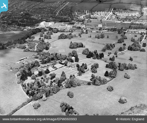
EPW060993 ENGLAND (1939). Shendish Manor, Shendish, 1939
© Copyright OpenStreetMap contributors and licensed by the OpenStreetMap Foundation. 2024. Cartography is licensed as CC BY-SA.
Nearby Images (4)
EPW060993

EPW060995

EPW060994

EPW017819

Details
| Title | [EPW060993] Shendish Manor, Shendish, 1939 |
| Reference | EPW060993 |
| Date | 22-May-1939 |
| Link | |
| Place name | SHENDISH |
| Parish | KINGS LANGLEY |
| District | |
| Country | ENGLAND |
| Easting / Northing | 505835, 204408 |
| Longitude / Latitude | -0.46743440085041, 51.727929786526 |
| National Grid Reference | TL058044 |
Pins
Be the first to add a comment to this image!


