
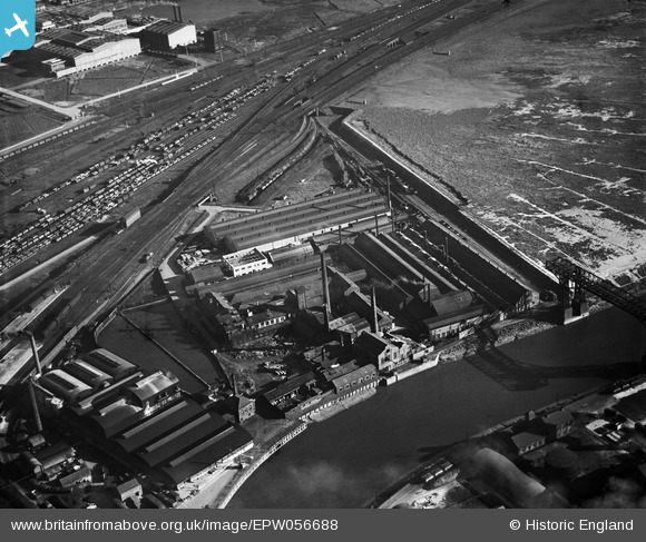
EPW056688 ENGLAND (1938). The Bank Quay Aluminium Rolling Mills, Warrington, 1938
© Copyright OpenStreetMap contributors and licensed by the OpenStreetMap Foundation. 2024. Cartography is licensed as CC BY-SA.
Nearby Images (9)
EPW056688

EPW056683

EPW056682

EPW056687

EPW056689

EPW056686

EPW056685

EPW056684

EPW052903
 under construction and environs, Warrington, 1937")
Details
| Title | [EPW056688] The Bank Quay Aluminium Rolling Mills, Warrington, 1938 |
| Reference | EPW056688 |
| Date | 31-March-1938 |
| Link | |
| Place name | WARRINGTON |
| Parish | |
| District | |
| Country | ENGLAND |
| Easting / Northing | 359869, 387589 |
| Longitude / Latitude | -2.6034041076519, 53.383357872674 |
| National Grid Reference | SJ599876 |
Pins
 Dylan Moore |
Sunday 16th of November 2014 05:42:52 PM |


