
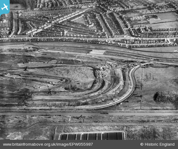
EPW055987 ENGLAND (1937). The William Girling Reservoir under construction, Lower Edmonton, 1937
© Copyright OpenStreetMap contributors and licensed by the OpenStreetMap Foundation. 2024. Cartography is licensed as CC BY-SA.
Nearby Images (26)
EPW055987

EPW053855
 Reservoir under construction, Edmonton, 1937")
EPW053841
 Reservoir under construction, Edmonton, 1937")
EPW049712

EPW053840
 Reservoir under construction, Edmonton, 1937")
EPW049714

EPW056325

EPW052273

EPW050869

EPW055982

EPW056316

EPW056822

EPW056817

EPW058468
 Reservoir under construction, Edmonton, 1938")
EPW056825

EPW060629

EPW056814

EPW060634

EPW060627

EPW058460
 Reservoir under construction, Edmonton, 1938")
EPW058471
 Reservoir under construction, Edmonton, from the south, 1938")
EPW049715

EPW049702

EPW053838
 Reservoir under construction, Edmonton, 1937")
EPW056326

EPW060209
 Reservoir under construction, Edmonton, 1938")
Details
| Title | [EPW055987] The William Girling Reservoir under construction, Lower Edmonton, 1937 |
| Reference | EPW055987 |
| Date | 9-November-1937 |
| Link | |
| Place name | LOWER EDMONTON |
| Parish | |
| District | |
| Country | ENGLAND |
| Easting / Northing | 536395, 193082 |
| Longitude / Latitude | -0.029578609892215, 51.619541970813 |
| National Grid Reference | TQ364931 |
Pins
Be the first to add a comment to this image!


