
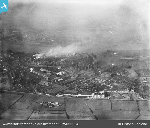
EPW055924 ENGLAND (1937). The South Durham Iron and Steel Works, South Bank, from the south-east, 1937
© Copyright OpenStreetMap contributors and licensed by the OpenStreetMap Foundation. 2024. Cartography is licensed as CC BY-SA.
Nearby Images (4)
EPW055924

EPW055912

EPW055913

EPW055911

Details
| Title | [EPW055924] The South Durham Iron and Steel Works, South Bank, from the south-east, 1937 |
| Reference | EPW055924 |
| Date | 28-October-1937 |
| Link | |
| Place name | SOUTH BANK |
| Parish | |
| District | |
| Country | ENGLAND |
| Easting / Northing | 452355, 520335 |
| Longitude / Latitude | -1.189994058432, 54.575391207866 |
| National Grid Reference | NZ524203 |


