
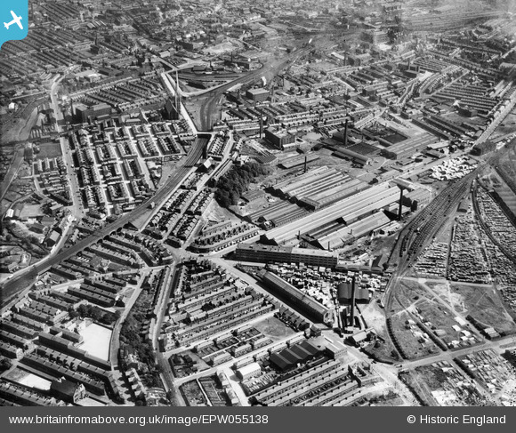
EPW055138 ENGLAND (1937). The English Electric Works and environs, Preston, 1937
© Copyright OpenStreetMap contributors and licensed by the OpenStreetMap Foundation. 2024. Cartography is licensed as CC BY-SA.
Nearby Images (8)
EPW055138

EPW034077

EPW034076

EPW034080

EPW034075

EPW034081

EPW034079

EPW034078

Details
| Title | [EPW055138] The English Electric Works and environs, Preston, 1937 |
| Reference | EPW055138 |
| Date | August-1937 |
| Link | |
| Place name | PRESTON |
| Parish | |
| District | |
| Country | ENGLAND |
| Easting / Northing | 352568, 429823 |
| Longitude / Latitude | -2.7195890922321, 53.762379237164 |
| National Grid Reference | SD526298 |
Pins
 wolrab64 |
Thursday 11th of March 2021 09:28:46 PM | |
wolrab64 |
Thursday 11th of March 2021 09:02:43 PM | |
Robert - Cumbria |
Tuesday 4th of February 2014 11:30:47 PM | |
Robert - Cumbria |
Tuesday 4th of February 2014 11:30:10 PM | |
Robert - Cumbria |
Tuesday 4th of February 2014 11:27:55 PM | |
Robert - Cumbria |
Tuesday 4th of February 2014 11:27:19 PM | |
Robert - Cumbria |
Tuesday 4th of February 2014 11:26:06 PM | |
Robert - Cumbria |
Tuesday 4th of February 2014 11:25:00 PM | |
Robert - Cumbria |
Tuesday 4th of February 2014 11:14:06 PM | |
Robert - Cumbria |
Tuesday 4th of February 2014 11:12:00 PM |


