
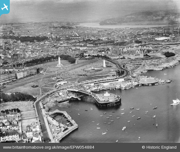
EPW054884 ENGLAND (1937). Promenade Pier and The Hoe, Plymouth, from the south-west, 1937
© Copyright OpenStreetMap contributors and licensed by the OpenStreetMap Foundation. 2024. Cartography is licensed as CC BY-SA.
Nearby Images (6)
EPW054884

EAW015157

EAW053019

EPW011266

EPW054896

EAW053020

Details
| Title | [EPW054884] Promenade Pier and The Hoe, Plymouth, from the south-west, 1937 |
| Reference | EPW054884 |
| Date | 16-August-1937 |
| Link | |
| Place name | PLYMOUTH |
| Parish | |
| District | |
| Country | ENGLAND |
| Easting / Northing | 247518, 53705 |
| Longitude / Latitude | -4.1441203965666, 50.362857364384 |
| National Grid Reference | SX475537 |
Pins
 Kentishman |
Wednesday 14th of November 2018 03:55:25 PM | |
Charles Dale |
Friday 8th of November 2013 12:40:54 PM | |
DavidWorth |
Wednesday 21st of August 2013 09:36:33 PM | |
DavidWorth |
Wednesday 21st of August 2013 09:33:21 PM | |
 Maurice |
Saturday 27th of July 2013 06:14:17 PM | |
Maurice |
Saturday 27th of July 2013 06:13:13 PM | |
Maurice |
Saturday 27th of July 2013 06:12:25 PM |
User Comment Contributions
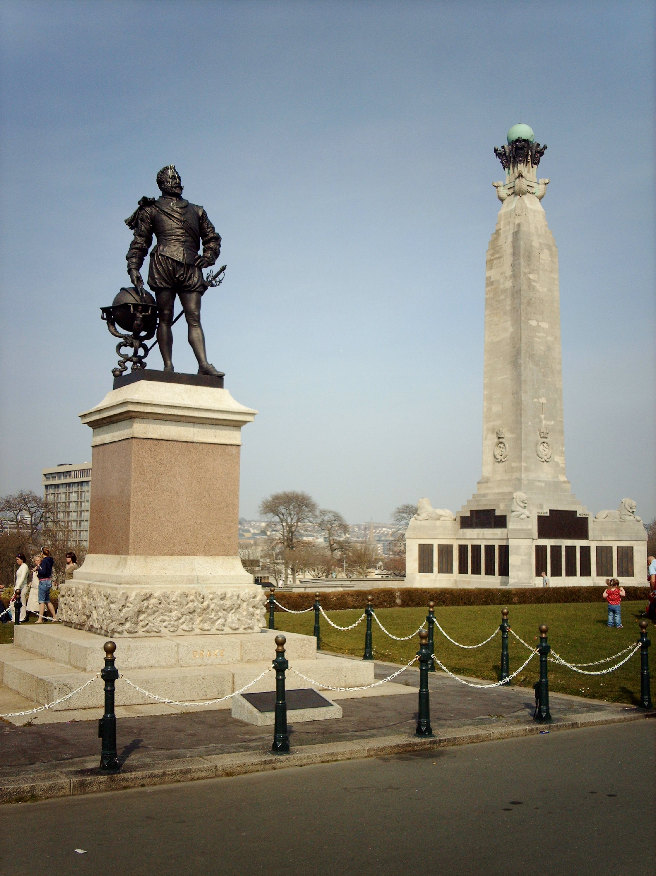 Drake's Statue and the Plymouth Naval Memorial 06/04/2007 |
 Class31 |
Thursday 31st of October 2013 08:33:45 PM |
 Looking east along the coast 06/04/2007 |
Class31 |
Thursday 31st of October 2013 08:30:28 PM |
 Smeaton Tower 06/04/2007 |
Class31 |
Thursday 31st of October 2013 08:25:00 PM |
 Smeaton Tower |
Class31 |
Thursday 31st of October 2013 08:21:52 PM |


