
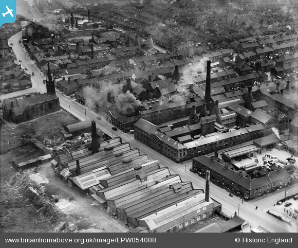
EPW054088 ENGLAND (1937). The British Pottery and Royal Albert and Victoria Potteries, Tunstall, 1937
© Copyright OpenStreetMap contributors and licensed by the OpenStreetMap Foundation. 2025. Cartography is licensed as CC BY-SA.
Nearby Images (8)
EPW054088

EPW054089

EPW045351

EPW045349

EPW045348

EPW045347

EPW045350

EPW045346

Details
| Title | [EPW054088] The British Pottery and Royal Albert and Victoria Potteries, Tunstall, 1937 |
| Reference | EPW054088 |
| Date | 7-July-1937 |
| Link | |
| Place name | TUNSTALL |
| Parish | |
| District | |
| Country | ENGLAND |
| Easting / Northing | 385872, 351744 |
| Longitude / Latitude | -2.2108436549246, 53.06245365599 |
| National Grid Reference | SJ859517 |
Pins
 mcgeacs |
Tuesday 13th of May 2014 12:35:45 PM | |
mcgeacs |
Tuesday 13th of May 2014 12:33:25 PM | |
mcgeacs |
Tuesday 13th of May 2014 12:32:10 PM | |
Katy Whitaker |
Monday 12th of May 2014 08:58:49 PM | |
Magdalena76th |
Monday 12th of May 2014 07:58:17 PM | |
Magdalena76th |
Monday 12th of May 2014 07:57:40 PM | |
Magdalena76th |
Monday 12th of May 2014 07:53:17 PM | |
Magdalena76th |
Monday 12th of May 2014 07:50:49 PM |