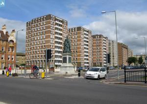
EPW054033 ENGLAND (1937). Kingsway, Queen's Gardens, King's Gardens and the town, Brighton, from the south-east, 1937
© Copyright OpenStreetMap contributors and licensed by the OpenStreetMap Foundation. 2024. Cartography is licensed as CC BY-SA.
Nearby Images (7)
Details
| Title | [EPW054033] Kingsway, Queen's Gardens, King's Gardens and the town, Brighton, from the south-east, 1937 |
| Reference | EPW054033 |
| Date | June-1937 |
| Link | |
| Place name | BRIGHTON |
| Parish | |
| District | |
| Country | ENGLAND |
| Easting / Northing | 529193, 104368 |
| Longitude / Latitude | -0.16554378519556, 50.823858796658 |
| National Grid Reference | TQ292044 |
Pins
 Alan McFaden |
Monday 9th of September 2013 12:24:30 PM |


![[EPW054033] Kingsway, Queen's Gardens, King's Gardens and the town, Brighton, from the south-east, 1937](http://britainfromabove.org.uk/sites/all/libraries/aerofilms-images/public/100x100/EPW/054/EPW054033.jpg)
![[EPW017735] Grand Avenue and the Prince's Hotel, Hove, 1927](http://britainfromabove.org.uk/sites/all/libraries/aerofilms-images/public/100x100/EPW/017/EPW017735.jpg)
![[EPW018068] Adelaide Crescent and environs, Hove, from the south, 1927](http://britainfromabove.org.uk/sites/all/libraries/aerofilms-images/public/100x100/EPW/018/EPW018068.jpg)
![[EAW043168] The seafront, Adelaide Crescent and the County Cricket Ground, Hove, from the south, 1952](http://britainfromabove.org.uk/sites/all/libraries/aerofilms-images/public/100x100/EAW/043/EAW043168.jpg)
![[EPW011502A] Adelaide Crescent and Palmeira Square, Hove, 1924. This image has been produced from a copy-negative.](http://britainfromabove.org.uk/sites/all/libraries/aerofilms-images/public/100x100/EPW/011/EPW011502A.jpg)
![[EPW039531] The Brunswick Lawns, Kings Way and the seafront, Hove, 1932](http://britainfromabove.org.uk/sites/all/libraries/aerofilms-images/public/100x100/EPW/039/EPW039531.jpg)
![[EPW041364] Third Avenue and environs, Hove, 1933](http://britainfromabove.org.uk/sites/all/libraries/aerofilms-images/public/100x100/EPW/041/EPW041364.jpg)
