
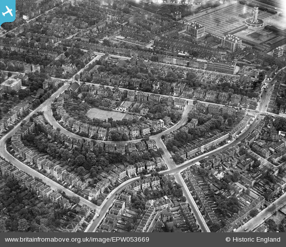
EPW053669 ENGLAND (1937). Hilldrop Crescent and environs, Tufnell Park, 1937
© Copyright OpenStreetMap contributors and licensed by the OpenStreetMap Foundation. 2024. Cartography is licensed as CC BY-SA.
Nearby Images (13)
EPW053669

EPW053672

EPW053664

EPW053667

EPW053673
 and environs, Tufnell Park, 1937. This image has been affected by flare.")
EPW053668

EPW053674

EAW005452

EPW053671

EAW005447

EAW005448

EPW005751

EAW005451

Details
| Title | [EPW053669] Hilldrop Crescent and environs, Tufnell Park, 1937 |
| Reference | EPW053669 |
| Date | 12-June-1937 |
| Link | |
| Place name | TUFNELL PARK |
| Parish | |
| District | |
| Country | ENGLAND |
| Easting / Northing | 529855, 185178 |
| Longitude / Latitude | -0.12692664568594, 51.550051486917 |
| National Grid Reference | TQ299852 |
Pins
 Class31 |
Wednesday 25th of March 2015 11:55:12 AM | |
 billyfern |
Wednesday 5th of November 2014 11:04:18 AM | |
billyfern |
Wednesday 5th of November 2014 11:03:55 AM | |
billyfern |
Wednesday 5th of November 2014 11:03:27 AM | |
billyfern |
Wednesday 5th of November 2014 11:02:56 AM | |
billyfern |
Friday 27th of June 2014 03:44:00 PM | |
billyfern |
Friday 27th of June 2014 03:43:38 PM | |
billyfern |
Friday 27th of June 2014 03:43:13 PM | |
billyfern |
Friday 27th of June 2014 03:42:55 PM | |
billyfern |
Friday 27th of June 2014 03:42:21 PM | |
billyfern |
Friday 27th of June 2014 03:42:03 PM |


