
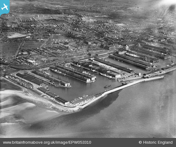
EPW053310 ENGLAND (1937). Gladstone Dock and environs, Bootle, 1937
© Copyright OpenStreetMap contributors and licensed by the OpenStreetMap Foundation. 2024. Cartography is licensed as CC BY-SA.
Nearby Images (10)
EPW053310

EPW057903

EPW057902

EPW050114

EPW023557

EPW018922

EPW023558

EPW023556

EPW053296

EPW023554

Details
| Title | [EPW053310] Gladstone Dock and environs, Bootle, 1937 |
| Reference | EPW053310 |
| Date | 27-May-1937 |
| Link | |
| Place name | BOOTLE |
| Parish | |
| District | |
| Country | ENGLAND |
| Easting / Northing | 332835, 395726 |
| Longitude / Latitude | -3.0115625452222, 53.453748751585 |
| National Grid Reference | SJ328957 |
Pins
Be the first to add a comment to this image!


