
Scheduled Maintenance
This website will undergo scheduled maintenance on Tuesday, September 10th, between 11:00 and 15:00, as well as on Thursday, September 12th, between 10:00 and 12:00. During this time, services may be temporarily disrupted. We apologise for any inconvenience.
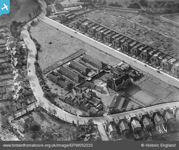
EPW052215 ENGLAND (1936). The Willesden General Hospital, Willesden Green, 1936
© Copyright OpenStreetMap contributors and licensed by the OpenStreetMap Foundation. 2024. Cartography is licensed as CC BY-SA.
Nearby Images (3)
EPW052215

EPW052213

EPW052214

Details
| Title | [EPW052215] The Willesden General Hospital, Willesden Green, 1936 |
| Reference | EPW052215 |
| Date | October-1936 |
| Link | |
| Place name | WILLESDEN GREEN |
| Parish | |
| District | |
| Country | ENGLAND |
| Easting / Northing | 522456, 184089 |
| Longitude / Latitude | -0.23397524640717, 51.541918064439 |
| National Grid Reference | TQ225841 |
Pins
 Chris Luck |
Monday 9th of September 2013 03:43:36 AM | |
Chris Luck |
Monday 9th of September 2013 03:31:57 AM | |
Chris Luck |
Monday 9th of September 2013 03:30:42 AM | |
Chris Luck |
Monday 9th of September 2013 03:27:05 AM |