
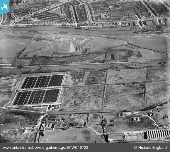
EPW049722 ENGLAND (1936). Edmonton Urban District Council Sewage Farm and the site of the southern end of the William Girling Reservoir showing preliminary construction works, Edmonton, 1936
© Copyright OpenStreetMap contributors and licensed by the OpenStreetMap Foundation. 2024. Cartography is licensed as CC BY-SA.
Nearby Images (14)
EPW049722

EPW049727

EPW049528

EPW048908

EPW049523

EPW056326

EPW058471
 Reservoir under construction, Edmonton, from the south, 1938")
EPW049702

EPW058465
 Reservoir under construction, Edmonton, 1938")
EPW049721

EPW058461
 Reservoir under construction and the River Lea, Edmonton, 1938")
EPW056319

EPW053843
 Reservoir under construction, Edmonton, 1937")
EPW056815

Details
| Title | [EPW049722] Edmonton Urban District Council Sewage Farm and the site of the southern end of the William Girling Reservoir showing preliminary construction works, Edmonton, 1936 |
| Reference | EPW049722 |
| Date | March-1936 |
| Link | |
| Place name | EDMONTON |
| Parish | |
| District | |
| Country | ENGLAND |
| Easting / Northing | 535975, 192952 |
| Longitude / Latitude | -0.035692726160263, 51.618475297023 |
| National Grid Reference | TQ360930 |
Pins
 G.Martin |
Tuesday 17th of June 2014 04:16:27 PM | |
Ray Flack |
Wednesday 13th of November 2013 12:12:05 PM | |
Ray Flack |
Wednesday 13th of November 2013 12:11:06 PM | |
Ray Flack |
Wednesday 13th of November 2013 12:10:16 PM | |
Ray Flack |
Wednesday 13th of November 2013 12:09:02 PM | |
Ray Flack |
Wednesday 13th of November 2013 12:08:27 PM | |
Ray Flack |
Wednesday 13th of November 2013 12:07:37 PM | |
Ray Flack |
Wednesday 13th of November 2013 12:06:13 PM | |
Ray Flack |
Wednesday 13th of November 2013 12:05:37 PM | |
Ray Flack |
Wednesday 13th of November 2013 12:04:25 PM | |
Ray Flack |
Wednesday 13th of November 2013 12:02:56 PM | |
Ray Flack |
Wednesday 13th of November 2013 11:54:48 AM |


