
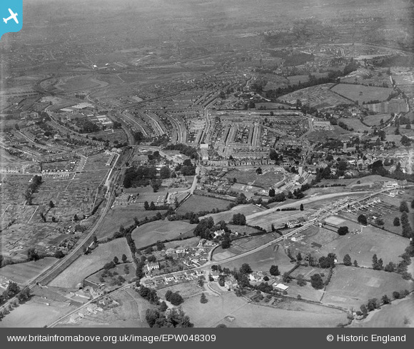
EPW048309 ENGLAND (1935). The Robertsons Preserve Works and the residential area surrounding Bristol Hill, Brislington, 1935
© Copyright OpenStreetMap contributors and licensed by the OpenStreetMap Foundation. 2024. Cartography is licensed as CC BY-SA.
Nearby Images (8)
EPW048309

EPW048308

EAW045825

EPW007316

EAW045828

EPW007315

EAW045831

EAW045829

Details
| Title | [EPW048309] The Robertsons Preserve Works and the residential area surrounding Bristol Hill, Brislington, 1935 |
| Reference | EPW048309 |
| Date | July-1935 |
| Link | |
| Place name | BRISLINGTON |
| Parish | |
| District | |
| Country | ENGLAND |
| Easting / Northing | 361709, 170722 |
| Longitude / Latitude | -2.5508982685974, 51.433711831265 |
| National Grid Reference | ST617707 |
Pins
 Calum Benton |
Monday 15th of May 2023 07:24:16 AM | |
Calum Benton |
Monday 15th of May 2023 07:23:32 AM | |
bakelentil |
Tuesday 30th of March 2021 12:11:49 PM | |
toriangel |
Saturday 19th of November 2016 09:17:57 AM | |
Geoff |
Wednesday 30th of July 2014 05:08:01 PM | |
Geoff |
Wednesday 30th of July 2014 05:03:01 PM | |
Geoff |
Wednesday 30th of July 2014 05:00:55 PM | |
Geoff |
Wednesday 30th of July 2014 04:51:49 PM | |
Geoff |
Wednesday 30th of July 2014 04:51:00 PM |