
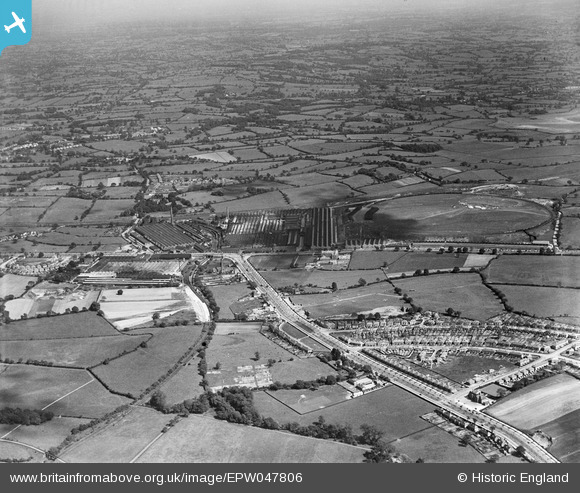
EPW047806 ENGLAND (1935). Longbridge Motor Works, Longbridge, from the north-west, 1935
© Copyright OpenStreetMap contributors and licensed by the OpenStreetMap Foundation. 2024. Cartography is licensed as CC BY-SA.
Nearby Images (6)
EPW047806

EPW047799

EPW047811

EPW047783

EPW047803

EPW047808

Details
| Title | [EPW047806] Longbridge Motor Works, Longbridge, from the north-west, 1935 |
| Reference | EPW047806 |
| Date | June-1935 |
| Link | |
| Place name | LONGBRIDGE |
| Parish | |
| District | |
| Country | ENGLAND |
| Easting / Northing | 400169, 277632 |
| Longitude / Latitude | -1.9975160241984, 52.396326976914 |
| National Grid Reference | SP002776 |
Pins
 PURCELL |
Sunday 6th of April 2014 09:57:14 AM | |
PURCELL |
Sunday 6th of April 2014 09:55:54 AM | |
PURCELL |
Sunday 6th of April 2014 09:55:09 AM | |
PURCELL |
Sunday 6th of April 2014 09:54:38 AM | |
PURCELL |
Sunday 6th of April 2014 09:53:58 AM | |
emu-star |
Thursday 28th of November 2013 10:18:23 AM | |
Confirm that it was a bowling green behind it. |
City Gardener |
Thursday 20th of February 2014 11:19:13 AM |


