
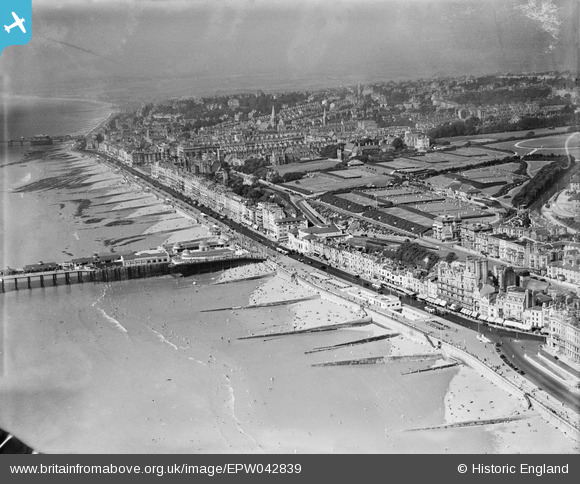
EPW042839 ENGLAND (1933). The Promenade, White Rock Pleasure Gardens and the town, Hastings, from the east, 1933
© Copyright OpenStreetMap contributors and licensed by the OpenStreetMap Foundation. 2024. Cartography is licensed as CC BY-SA.
Nearby Images (26)
EPW042839

EAW002407

EPW035339

EPW000115

EPW000754

EPW039390

EPW026200

EPW044648

EAW002406

EAW022975

EPW026209

EPW039388

EPW000060B

EPW035334

EPW039370

EAW002408

EPW026191

EPW026192

EPW044645

EPW039369

EPW039366

EPW026188

EPW035346

EPW044647

EPW044646

EPW044644

Details
| Title | [EPW042839] The Promenade, White Rock Pleasure Gardens and the town, Hastings, from the east, 1933 |
| Reference | EPW042839 |
| Date | August-1933 |
| Link | |
| Place name | HASTINGS |
| Parish | |
| District | |
| Country | ENGLAND |
| Easting / Northing | 581354, 109155 |
| Longitude / Latitude | 0.57679313973704, 50.852880212271 |
| National Grid Reference | TQ814092 |
Pins
Be the first to add a comment to this image!


