
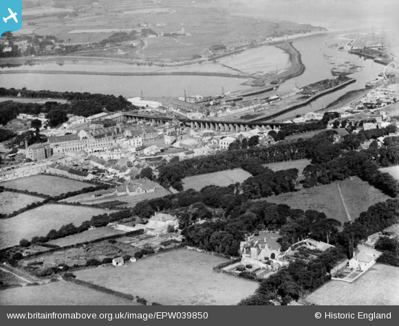
EPW039850 ENGLAND (1932). The railway viaduct and environs, Hayle, 1932. This image has been produced from a copy-negative.
© Copyright OpenStreetMap contributors and licensed by the OpenStreetMap Foundation. 2024. Cartography is licensed as CC BY-SA.
Nearby Images (3)
EPW039850

EPW021741

EPW007419

Details
| Title | [EPW039850] The railway viaduct and environs, Hayle, 1932. This image has been produced from a copy-negative. |
| Reference | EPW039850 |
| Date | August-1932 |
| Link | |
| Place name | HAYLE |
| Parish | HAYLE |
| District | |
| Country | ENGLAND |
| Easting / Northing | 155951, 37129 |
| Longitude / Latitude | -5.4190138657475, 50.183200030854 |
| National Grid Reference | SW560371 |
Pins

User Comment Contributions
 The view from the railway viaduct, Hayle, 15/04/2015 |
 Class31 |
Sunday 19th of April 2015 07:26:04 AM |


