
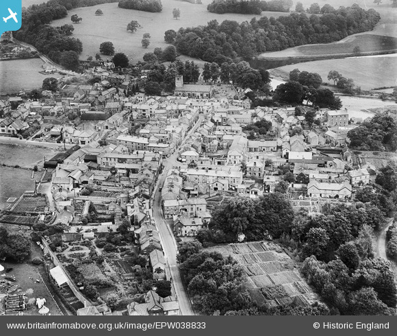
EPW038833 ENGLAND (1932). Main Street and St Mary's Church, Kirkby Lonsdale, 1932
© Copyright OpenStreetMap contributors and licensed by the OpenStreetMap Foundation. 2024. Cartography is licensed as CC BY-SA.
Nearby Images (4)
EPW038833

EPW038836

EPW038832

EPW038834

Details
| Title | [EPW038833] Main Street and St Mary's Church, Kirkby Lonsdale, 1932 |
| Reference | EPW038833 |
| Date | July-1932 |
| Link | |
| Place name | KIRKBY LONSDALE |
| Parish | KIRKBY LONSDALE |
| District | |
| Country | ENGLAND |
| Easting / Northing | 361169, 478642 |
| Longitude / Latitude | -2.5953364875828, 54.201889066395 |
| National Grid Reference | SD612786 |
Pins
 Simon |
Wednesday 30th of December 2020 08:44:48 AM | |
Getting Older! |
Wednesday 26th of August 2015 09:46:52 PM | |
Getting Older! |
Wednesday 26th of August 2015 09:44:53 PM |


