
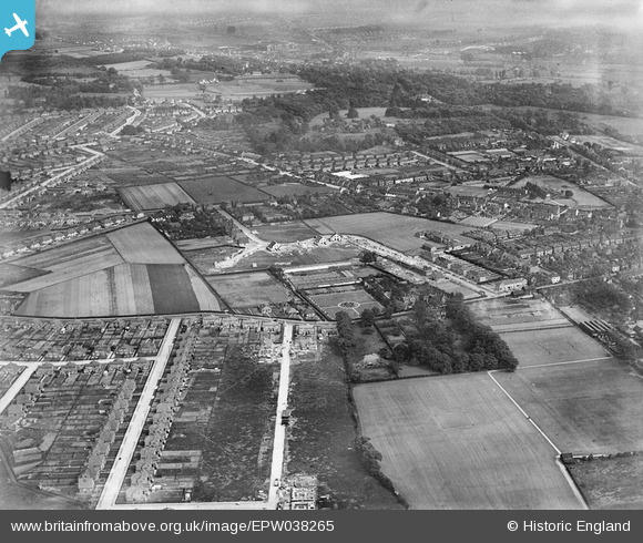
EPW038265 ENGLAND (1932). Construction of new housing at Pelham Road and environs, Bexleyheath, from the north-west, 1932
© Copyright OpenStreetMap contributors and licensed by the OpenStreetMap Foundation. 2024. Cartography is licensed as CC BY-SA.
Nearby Images (3)
EPW038265

EPW038262

EPW038267

Details
| Title | [EPW038265] Construction of new housing at Pelham Road and environs, Bexleyheath, from the north-west, 1932 |
| Reference | EPW038265 |
| Date | June-1932 |
| Link | |
| Place name | BEXLEYHEATH |
| Parish | |
| District | |
| Country | ENGLAND |
| Easting / Northing | 549167, 175766 |
| Longitude / Latitude | 0.14745777981394, 51.46069827798 |
| National Grid Reference | TQ492758 |
Pins
 SirTricky |
Friday 25th of July 2014 05:53:36 PM | |
SirTricky |
Friday 25th of July 2014 05:52:55 PM | |
SirTricky |
Friday 25th of July 2014 05:51:55 PM | |
SirTricky |
Friday 25th of July 2014 05:51:28 PM | |
SirTricky |
Friday 25th of July 2014 05:50:32 PM | |
SirTricky |
Friday 25th of July 2014 05:49:29 PM |


