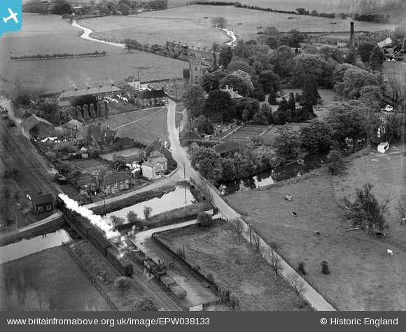
EPW038133 ENGLAND (1932). The road and railway bridges over the Great Stour, Chartham, 1932
© Copyright OpenStreetMap contributors and licensed by the OpenStreetMap Foundation. 2025. Cartography is licensed as CC BY-SA.
Details
| Title | [EPW038133] The road and railway bridges over the Great Stour, Chartham, 1932 |
| Reference | EPW038133 |
| Date | May-1932 |
| Link | |
| Place name | CHARTHAM |
| Parish | CHARTHAM |
| District | |
| Country | ENGLAND |
| Easting / Northing | 610484, 155086 |
| Longitude / Latitude | 1.0168338919967, 51.255513167494 |
| National Grid Reference | TR105551 |
Pins
Be the first to add a comment to this image!


![[EPW038133] The road and railway bridges over the Great Stour, Chartham, 1932](http://britainfromabove.org.uk/sites/all/libraries/aerofilms-images/public/100x100/EPW/038/EPW038133.jpg)
![[EAW004716] The village, Chartham, 1947](http://britainfromabove.org.uk/sites/all/libraries/aerofilms-images/public/100x100/EAW/004/EAW004716.jpg)
![[EAW004717] The village, Chartham, 1947](http://britainfromabove.org.uk/sites/all/libraries/aerofilms-images/public/100x100/EAW/004/EAW004717.jpg)
![[EAW004718] The village, Chartham, 1947](http://britainfromabove.org.uk/sites/all/libraries/aerofilms-images/public/100x100/EAW/004/EAW004718.jpg)