
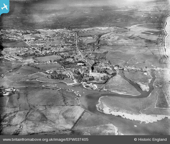
EPW037405 ENGLAND (1932). Christ Church, the River Stour and the town, Christchurch, 1932
© Copyright OpenStreetMap contributors and licensed by the OpenStreetMap Foundation. 2024. Cartography is licensed as CC BY-SA.
Nearby Images (16)
EPW037405

EAW034631

EPW037406

EAW034629

EPW013615

EAW034632

EAW034630

EPW013614

EPW018171

EPW037439

EPW013616

EPW018172

EPR000280

EPR000281

EAW049063

EAW034633

Details
| Title | [EPW037405] Christ Church, the River Stour and the town, Christchurch, 1932 |
| Reference | EPW037405 |
| Date | April-1932 |
| Link | |
| Place name | CHRISTCHURCH |
| Parish | |
| District | |
| Country | ENGLAND |
| Easting / Northing | 415901, 92658 |
| Longitude / Latitude | -1.7746620921355, 50.732747391183 |
| National Grid Reference | SZ159927 |
Pins
Be the first to add a comment to this image!


