
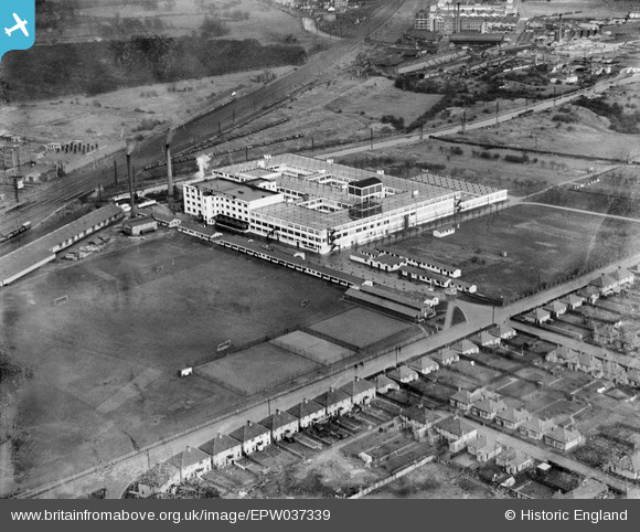
EPW037339 ENGLAND (1932). The Nestle Cocoa Factory, Hayes, 1932
© Copyright OpenStreetMap contributors and licensed by the OpenStreetMap Foundation. 2024. Cartography is licensed as CC BY-SA.
Nearby Images (6)
EPW037339

EPW032898

EPW032899

EPW032897

EPR000461

EPW061232

Details
| Title | [EPW037339] The Nestle Cocoa Factory, Hayes, 1932 |
| Reference | EPW037339 |
| Date | April-1932 |
| Link | |
| Place name | HAYES |
| Parish | |
| District | |
| Country | ENGLAND |
| Easting / Northing | 510044, 179202 |
| Longitude / Latitude | -0.41442613923604, 51.500545881703 |
| National Grid Reference | TQ100792 |
Pins
 Phil Marsden |
Wednesday 26th of February 2014 04:11:48 PM | |
 Class31 |
Saturday 30th of March 2013 09:48:32 PM |


