
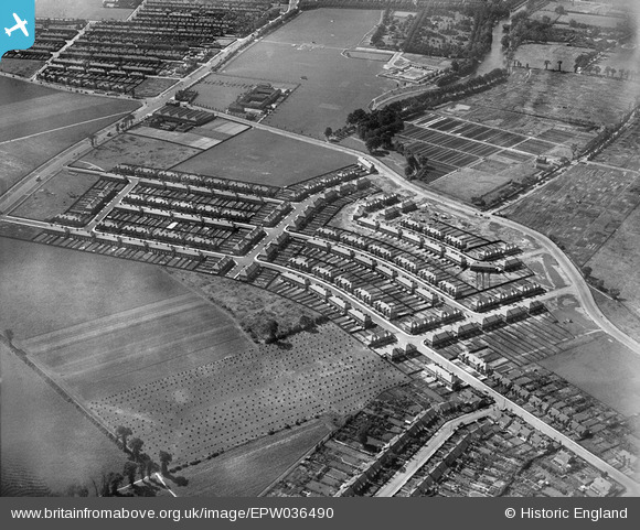
EPW036490 ENGLAND (1931). New housing at Ashburton Avenue, Ilford, 1931
© Copyright OpenStreetMap contributors and licensed by the OpenStreetMap Foundation. 2024. Cartography is licensed as CC BY-SA.
Nearby Images (5)
EPW036490

EPW036491

EPW036489

EPW036492

EPW036493

Details
| Title | [EPW036490] New housing at Ashburton Avenue, Ilford, 1931 |
| Reference | EPW036490 |
| Date | August-1931 |
| Link | |
| Place name | ILFORD |
| Parish | |
| District | |
| Country | ENGLAND |
| Easting / Northing | 545396, 185592 |
| Longitude / Latitude | 0.097260275672195, 51.549980801374 |
| National Grid Reference | TQ454856 |
Pins
 Hermann the German |
Tuesday 15th of August 2017 02:41:33 PM | |
Hermann the German |
Sunday 13th of August 2017 07:56:50 PM | |
Hermann the German |
Sunday 13th of August 2017 07:55:56 PM | |
Hermann the German |
Sunday 13th of August 2017 07:55:15 PM | |
Hermann the German |
Sunday 13th of August 2017 07:53:07 PM |


